
How I found hundreds of forgotten kurgans in Ukraine in 48 hours
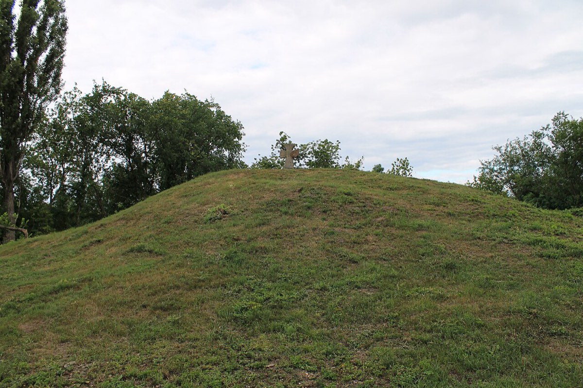
Kurgans are earth mounds raised over graves. The oldest are older than the Egyptian pyramids. There were once tens of thousands; today almost all are ploughed flat, and people drive past them every day without noticing. I searched for them in free satellite images and on declassified film from a 1982 American spy satellite.
Where the idea came from
I was inspired by a post by Pietro Miotti. On holiday, he asked AI agents to look for ancient structures in open lidar data (laser scans of the ground) over Mexico. Within days they found a Maya site that none of the papers they checked mentioned, and he reported it to Mexico's national archaeology institute. The next day it turned out archaeologists had already described it in 2025. But what stuck with me was this: anyone with a computer can now search like that. Ukraine has no open lidar. It does have free satellites, and film once shot to count Soviet missiles. And there is plenty to look for here.
What struck me most is how fast this can be done now. In two days, working with an AI assistant (Claude), I combined ten years of free Sentinel-2 satellite images, declassified film from a 1982 spy satellite, Soviet military maps, OpenStreetMap and open lists of heritage sites. The AI wrote the code, trained the model and checked the results; I asked the questions and looked at the images. To check how accurate my search is, I used the map of the British-Ukrainian AARG group, who spent several years mapping kurgans by hand.
Who lies under the kurgans
The first big kurgans were raised by the Yamnaya people about 5,000 years ago: herders with wagons and herds. Their descendants spread thousands of kilometres, and traces of their DNA are found in most Europeans today. Many scholars think the ancestor of Ukrainian, English, Persian and Hindi spread from these steppes. The answer to "where do our languages come from" is being found partly in graves like these.
Later came the Scythians. Herodotus described their royal funerals under tall mounds, and the Bilsk hillfort in Poltava oblast is one of the largest settlements of its age in Europe. After the Scythians came the Sarmatians, then other nomads, and Cossacks kept watch from the mounds.
What archaeologists found in kurgans
Much of what we know about the people who lived here before the Slavs comes from kurgans. Here are a few finds that changed how we see them.
 Drawing: Svitlana Ivanova, CC BY 4.0
Buried with a wagon
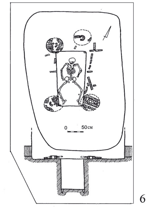
The first big kurgans. The dead were laid in a pit under the mound and covered in red ochre. The most important were sometimes buried with a wooden wagon. One such wagon was found in 1949 in Storozhova Mohyla by the Dnipro.
In 2015 geneticists read DNA from ancient graves. About 4,500 years ago, people from the steppe moved west in large numbers: the Corded Ware people of Germany had about three quarters Yamnaya ancestry. This supported the old idea that Indo-European languages spread from the steppe too.
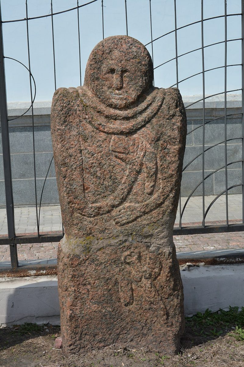 Photo: Nataliya Shestakova, CC BY-SA 4.0
Stone warriors on top
Two thousand years later the steppe belonged to the Scythians. They put stone statues of warriors on their kurgans. This one was found in 1964 near Mederove.
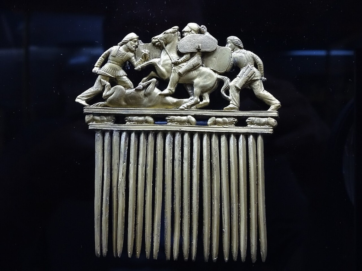 Photo: Adam Jones from Kelowna, BC, Canada, CC BY-SA 2.0
A warrior in gold
In 1912–1913 the side tomb of a kurgan near Nikopol held a man covered in gold, with a weapon bearer, a servant and five horses. Among the objects was a gold comb with three warriors fighting. The photo shows a replica; the original is in the Hermitage.
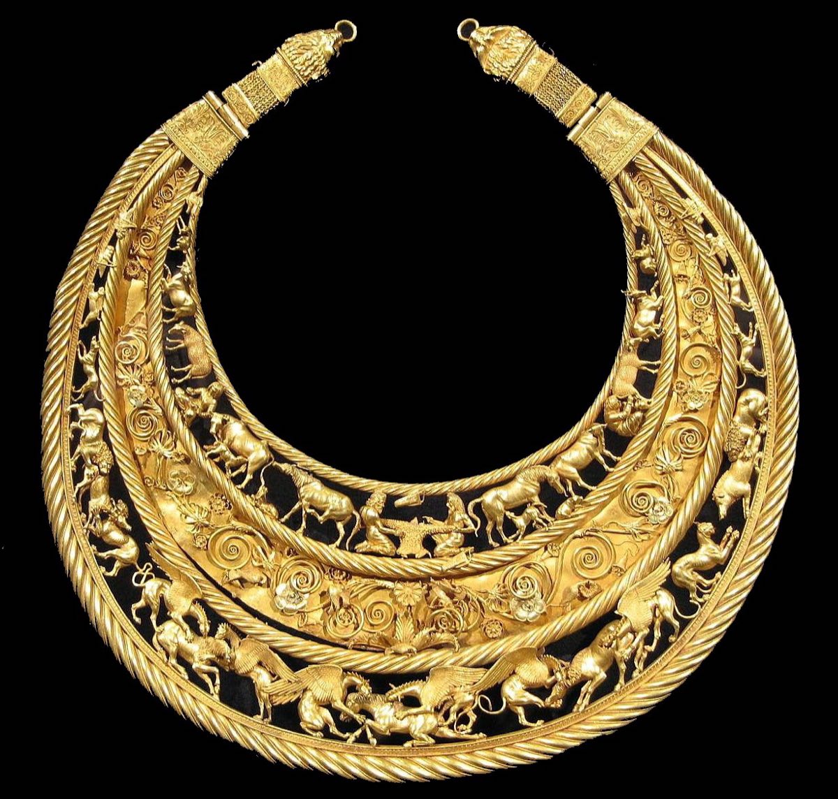
Scythian gold, Greek work
The pectoral from a kurgan near Pokrov, Dnipropetrovsk oblast: more than a kilogram of gold. The style is Greek; the scenes are from Scythian life. Greek writers described Scythians as wild nomads; the graves show a rich elite ordering work from the best craftsmen.
Photo: Terminator, public domainOn the lower Don and Volga about one in five warrior graves belongs to a woman, and among the Sarmatians up to a quarter. Many researchers link such women to the Greek legends of the Amazons.
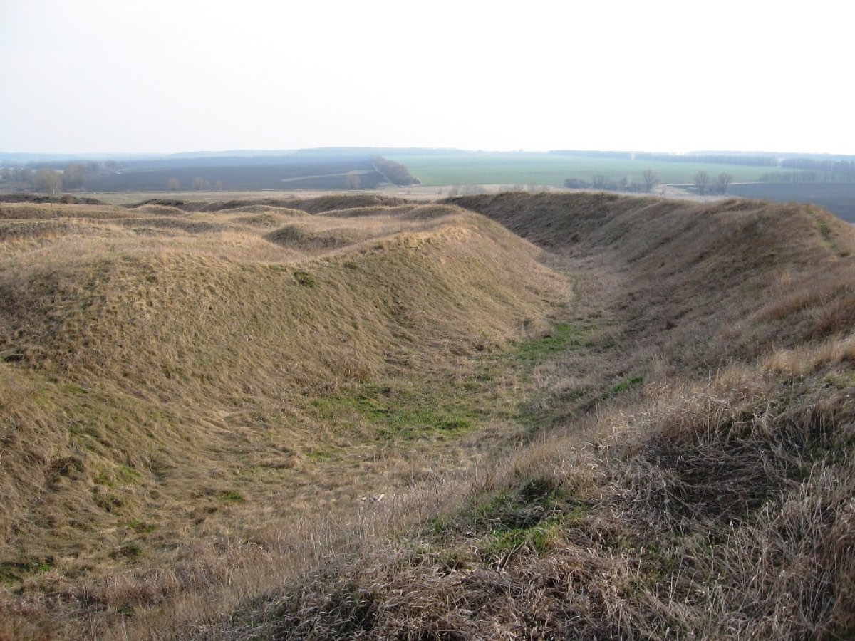 Photo: Mpas, CC BY-SA 1.0
Close to home
In 1996 a Ukrainian-Polish team excavated a kurgan about 9 m high near Ryzhanivka, Cherkasy oblast, and found the grave of a Scythian chief that looters had never reached. The researchers called it the only one of its kind known. The ramparts of the Bilsk hillfort in Poltava oblast, in the photo, still stand; large kurgan cemeteries surround it.
What I found
How to spot a grave from orbit
In spring a field is bare and brown. But tractors don't plough the mound itself: grass or a few trees survive there. From a satellite it looks like a small green island in the middle of ploughland. That is exactly what my model looks for in eight years of Sentinel-2 images.
Spot the kurgan: known ones and new finds
Each square is a 250×250 m patch in spring 2025 (one pixel is 10×10 m), the red circle marks the spot I check. These are the clearest examples from each group. Not every find looks this clear: some are faint smudges.
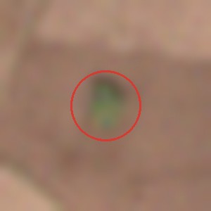
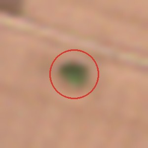
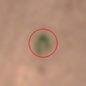
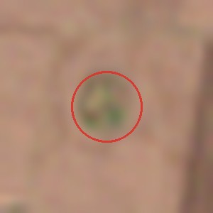
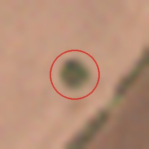
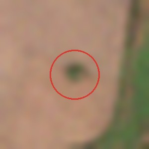
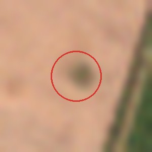
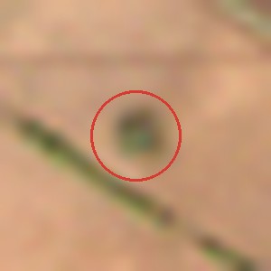
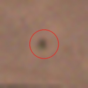
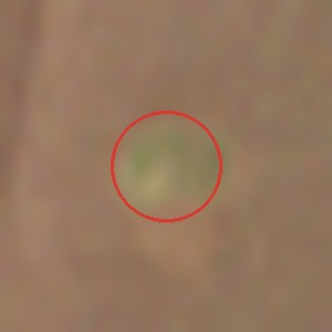
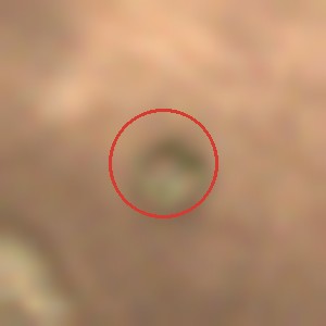
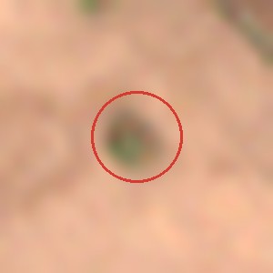
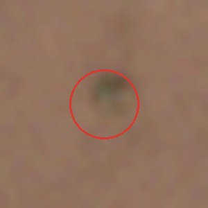
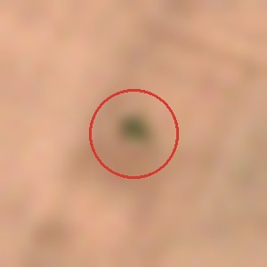
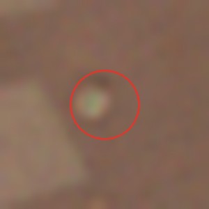
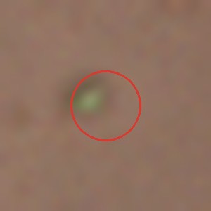
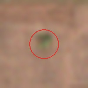
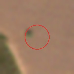
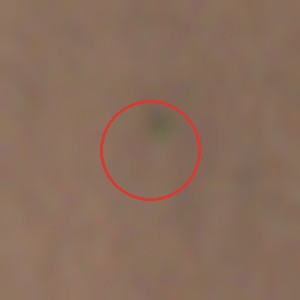
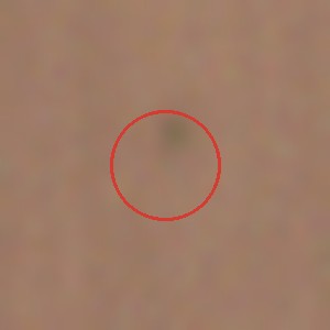
How many are real? I checked blind: 80 places on sharp aerial photos, a mix of my finds, known kurgans and random nearby spots, without knowing which was which. I recognised 13 of 15 known kurgans and none of the random spots. Among the strongest finds about one in three turned out to be a kurgan; among the weaker ones, one in ten. Together that is about 400 kurgans that no open register lists. Some ploughed kurgans can't be seen from the air at all, so the real number may be higher. Archaeologists on the ground will have the final word.
Your turn: find the kurgan
Ten images. Some show real kurgans, some an empty field, and some my new finds that nobody has checked yet. Is there a kurgan inside the red circle?
A kurgan in the circle?
Why here: Scythian land
Many finds cluster in the Tiasmyn valley, around Chyhyryn and Kamianka. This is where the Motronynske hillfort stood, one of the largest Scythian settlements, with about 80 barrows counted around it. Scythian burials have also been dug near Zhabotyn and Mykhailivka. And next to many of my strongest finds, Soviet maps from the 1970s carry a "kurgan" mark: half a century ago, surveyors still saw them.

Seven areas, from Korsun to Bilsk
I scanned seven areas of 2,000–4,000 km² each. Most finds sit in the band between Chyhyryn and Kirovohrad oblast, around Korsun and Kaniv, and near Nebelivka in Kirovohrad oblast, next to a Trypillia mega-settlement. Two areas were picked for their story: Bilsk in Poltava oblast, where archaeologists are excavating the Scythian necropolis of Skorobir with up to a thousand mounds right now, and Skobeleve in Mykolaiv oblast, where looters dug into a 12-metre "royal" kurgan with an excavator in 2020 and the case was closed unsolved.
Explore it yourself
Green dots are known kurgans from open data: tap one and the map flies to the real mound on detailed imagery. Yellow 10×10 km squares are where I found new likely kurgans: tap to see what they look like. The dashed rectangle is the area the AARG expert group surveyed by hand.
New finds are shown only as squares, never as exact spots. Imagery: Esri World Imagery.
Time machine: the same mounds in 1982
On 18 May 1982 a US HEXAGON spy satellite passed over Cherkasy oblast. It shot on film and dropped the film in capsules on parachutes, which aircraft caught in mid-air. The film was declassified long ago, and it shows every house. I matched those photos to today’s using landmarks: crossroads, bridges, village streets. Left is 1982, right is 2025. In the old photos the kurgans are sharp and round; today only faint smudges remain.
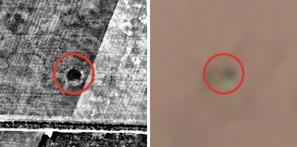
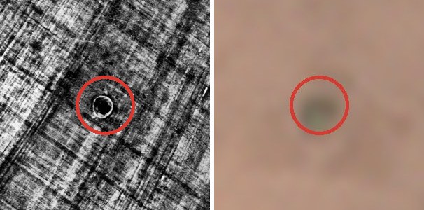
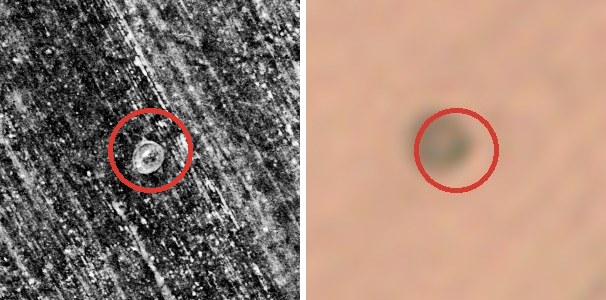
The red circle sits on the kurgan. Matching 44-year-old film to today’s maps leaves an error of 20–100 m, so I lined up each 1982 photo on the mound itself. Patches are 450×450 m; all three are my new finds.
How many are left
I took 300 random kurgans mapped by the British archaeologists of AARG and looked at each one on the 1982 film, without knowing what happened to it later. The result surprised me: even then only one in 25 still stood as a mound. Most had been ploughed flat in Soviet times, and by 1982 only rings and smudges in the fields were left. Of the kurgans that Soviet military maps show as mounds, about one in three still stands today.
The conclusion is simple: the kurgans disappeared long ago, not now. The big destruction happened in the Soviet decades, when fields were ploughed end to end. The survivors are holding on: of 1,310 standing kurgans I checked on the images, only 2 to 4 were ploughed out or damaged in 2017–2026. Slow flattening by the plough can't be seen from space, so the real loss is a bit higher, but not several times higher.
These numbers are preliminary. Two people rated the 1982 photos independently, and the share of standing mounds came out the same (4%); an expert view is still to come. I checked every automatic loss signal by eye on sharp aerial photos from different years.
Are they worth protecting?
Yes, and not only the ones still standing. The graves under a kurgan are dug deep into the subsoil, below the plough, so even a flat field often still holds the burials. A standing kurgan keeps more: later burials inside the mound itself, and the soil beneath it, sealed thousands of years ago. That soil is a snapshot of the ancient steppe, used to reconstruct past climate. Graves like these are how geneticists learned about the Yamnaya, and historians about the Scythians.
By law, archaeological sites belong to the state, and destroying them or digging without a permit is a crime. In practice, though, protection works for kurgans that are in the register with marked boundaries. Most of my finds are on no open list. So the most useful thing this project can give is a list of places for archaeologists and regional heritage offices, so these kurgans get checked and registered.
War and kurgans
I compared kurgans on free and occupied territory (without the 30 km belt near the front). On occupied land the satellite showed more signals, but almost all of them are from 2025 in Crimea, where the islands faded for every mound at once. Most likely the fields changed or irrigation came back. And on free territory such signals mostly turned out to be false. So from space I cannot show that the war is destroying kurgans on a large scale. Single cases are documented: trenches dug into kurgans in Zaporizhzhia oblast, and over 200 damaged sites in Crimea according to Ukraine's Ministry of Culture. Looters' pits are smaller than one image pixel, so they need other ways to find.
What's next
- Show the finds to archaeologists and regional heritage officials, so they can be checked on the ground.
- Ask archaeologists to rate the 1982 photos independently.
- Match more of the 1982 photos: they also show the rings of mounds already ploughed by then, which today’s satellites cannot see.
- Extend the search to other oblasts.
Exact locations go only to heritage professionals. I propose no fieldwork near the front or on occupied land.